Tahoe and Vicinity September 25, 2022

Hidden Delight

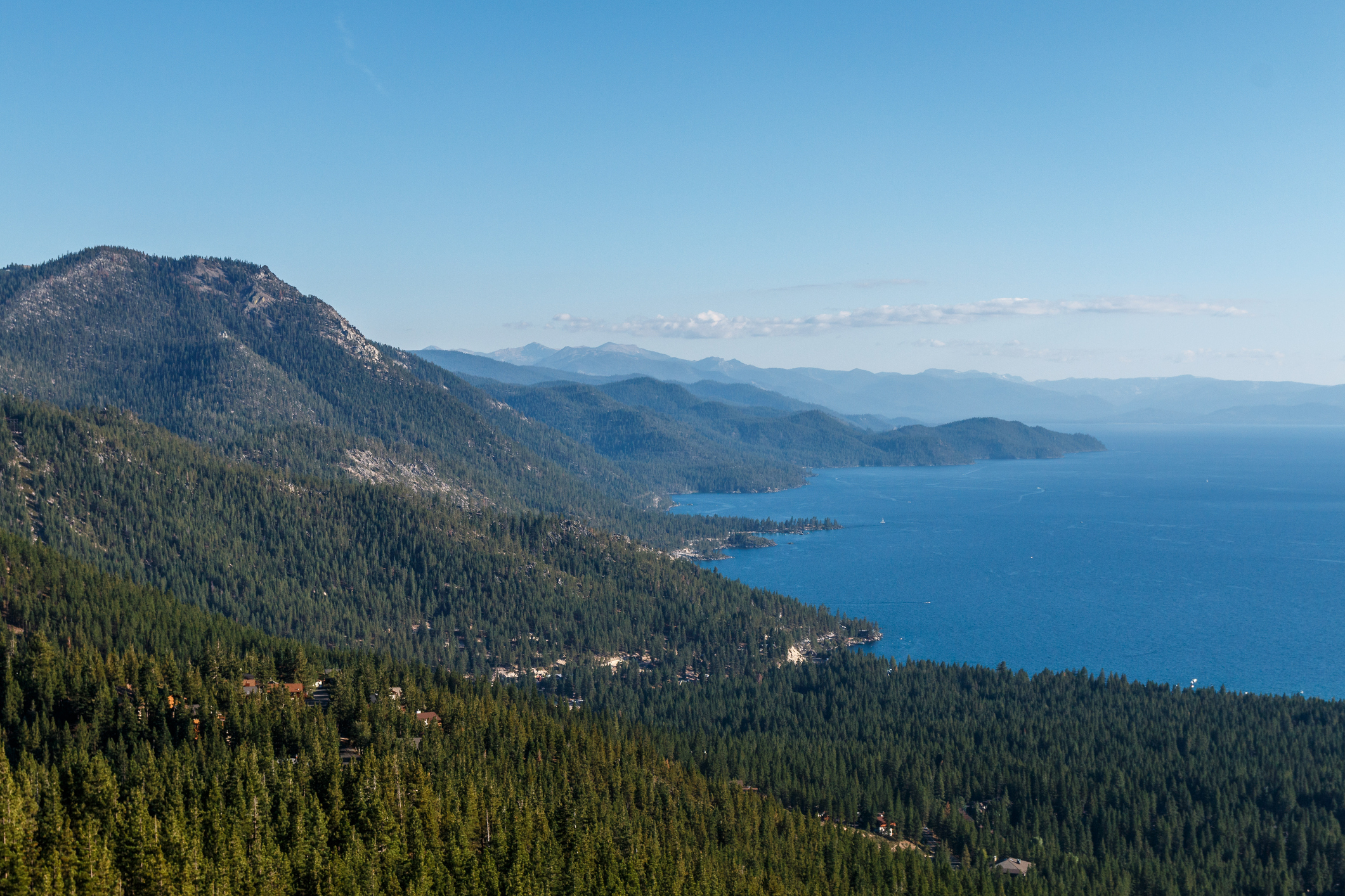
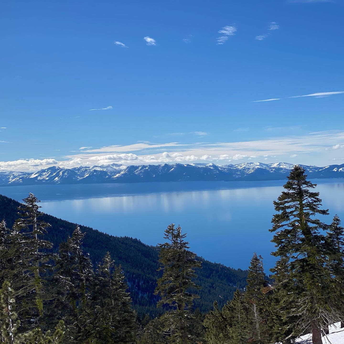
One unique feature on Lake Tahoe’s north shore is definitely under-used, mostly because it is off the beaten track for tourists and locals alike. The pools of the Lake’s one and only waterside hot springs sit empty much of the time.

The source of the hot springs bubbles up on the Brockway Springs Lakefront Resort’s property and there is no public access to this gated community of privately owned condominiums. 

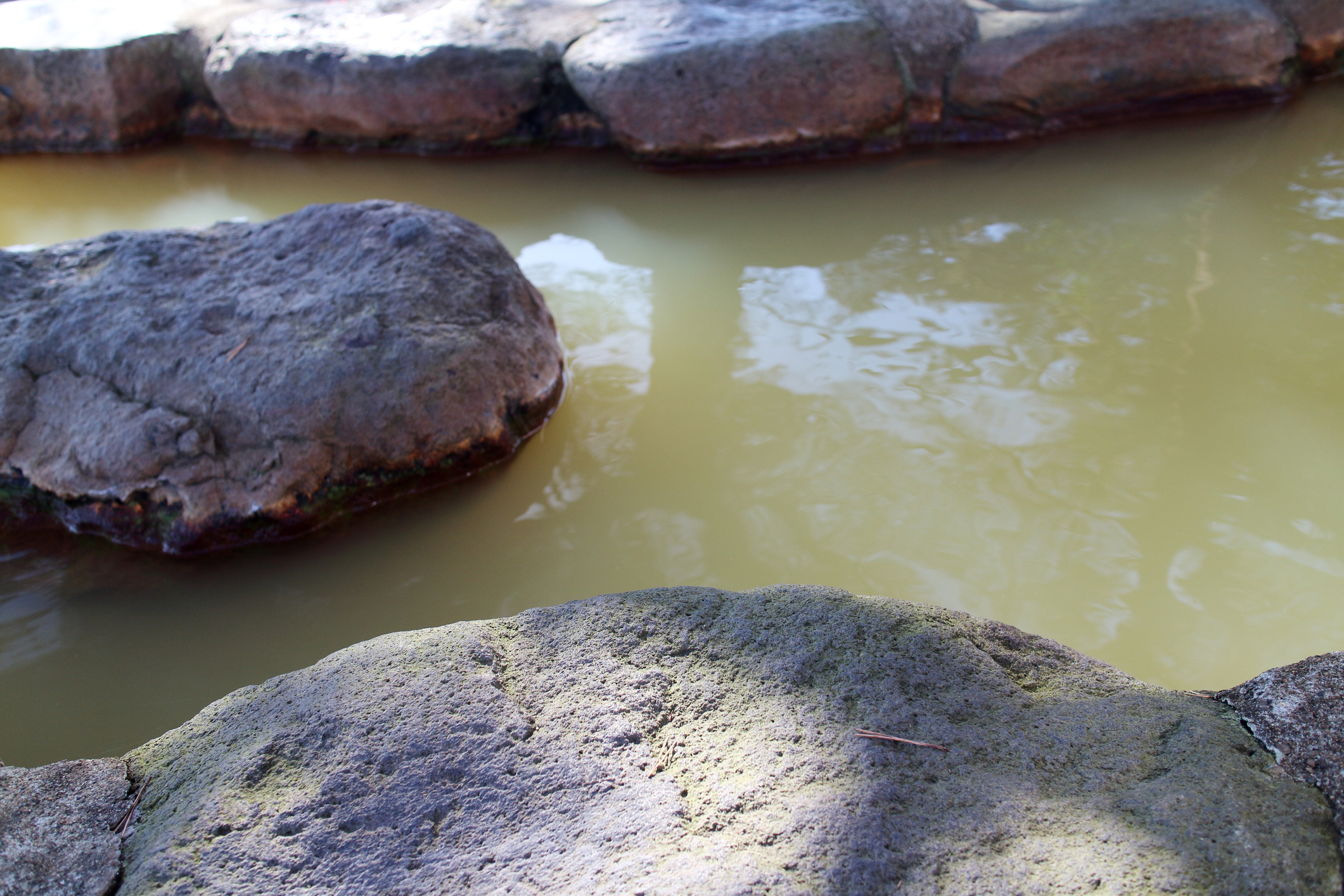
However, the hot springs’ outflow trickles down into natural rock walled pools sitting on the edge of the Lake. These pools, located below Tahoe’s high water mark, are always waiting for the serious soakers arriving on SUPs, or in kayaks, or motor boats. 

It is less than a mile’s paddle from the King’s Beach boat ramp to the soaking pools. Head towards the California-Nevada border to find the natural pools only a few yards past the Brockway Springs swimming pool. Then it’s a few steps through Lake Tahoe’s chilly waters, and a short scramble over a Tahoe boulder or two, for a rest in the toasty warm water while being impressed by superb views. Take care, though, don’t just jump in. Test the water first, because sometimes the springs’ water is hot enough to burn. As always, be respectful of private property, stay outside of its boundaries. 

Traditional stories from the Washoe people tell of their ancestors’ summer migrations  to the “Lake of the Sky.” Naturally, they also took advantage of a good soak in the comfortable waters of the springs. This habit of theirs continued well into the time of European settlement.

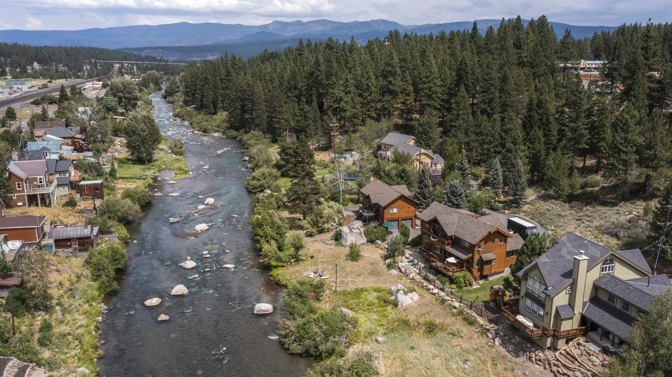
About 150 years ago, William Campbell and George Schaffer graded a dirt road from Truckee to the hot springs. The road conveniently brought tourists from the Truckee railroad stop to Mr. Campbell’s guest cabins built by the springs. Campbell’s Hot Springs quickly became one of Tahoe’s first commercial resorts.

In 1884, a tourist pamphlet, promoting Campbell’s Resort stated: “The water boils out in several places in great volume. The hotel is comfortable; the charge $3.00 a day; the entire lake is seen from the house, and the baths are an advantage to be had nowhere else on the lake.”

That inviting place is still on Lake Tahoe’s shores, with a few changes. Of course, the price of a room is somewhat over $3.00, and no one has to bump for hours over a dirt road in a horse drawn wagon. The hot water, though, continues to “boil out” as it has for centuries.

According to Google Maps, Brockway hot springs lies about 11 miles from Mt. Pluto, which is an extinct volcano, and about 12 miles away from Mt. Rose, another extinct volcano. 

Naturally, with all that latent seismic activity, more than one fault line is nearby. Ground water can circulate through those fault zones, and, as they are damaged zones of high permeability, the heat rises from great depths creating hot springs.

Tahoe has always attracted health seekers who have trusted that these mountains will revitalize them physically as well as mentally. Looks like they may be right

Tahoe and Vicinity November 10, 2021

The Washoe

The word Washoe means “people from here,” which is an apt description for a group of people who have called this area home for more than 6,000 years. Many generations have lived on and with this land, each gathering knowledge and wisdom to pass forward. It’s no wonder that The Committee on Energy and Natural Resources officially granted cultural custody over land around Lake Tahoe to the Washoe Tribe of Nevada and California.

Oral history of the Washoe people tells about encounters with the 1846/1847 Donner party, and recent archaeologic evidence backs up their stories. More than once Washoe scouts tried to help the stranded pioneers with offerings of food, which the Donner party rebuffed, on occasion with violence. When a scout observed dead bodies being cannibalized, the Washoe people gave up and retreated. From then on they referred to the Donner party as “not people.”

After the Donner camp was deserted, the Washoe people, aiming to rid the area of bad spirits, returned to the site to burn or bury anything left behind.

Two years earlier, the Washoe had also proven their kindness by sharing food — edible pine nuts — and finding a safe passage to California for John Fremont, who was leading an 1844 government survey expedition. After struggling through the deep snow, an impressed Fremont wrote about the Washoe skill with their snowshoes.

Washoe hunters made snowshoes by bending a manzanita branch into a circle, then lacing strips of deer hide across the circle. The hunters also equipped themselves with long poles to use while snowshoeing.

As with any native people, the Washoe were experts in gathering and using natural materials for their daily needs. And being hunter/gatherers instead of famers, these people needed lightweight baskets to carry their belongings during the seasonal valley-to-mountain-to-valley moves.

Then, between 1890 and 1935, the Arts and Crafts movement created a new appreciation for nature and all things natural. With the railroad making a trip into nature easier for city dwellers, Lake Tahoe tourism swelled. The every-day baskets made by Washoe weavers became easy to obtain, and therefore, collectable. Because the popularity of baskets provided weavers with an income, basket makers concentrated on weaving more difficult and intricate designs.

The Gatekeeper’s Museum in Tahoe City has an extensive collection of Native American baskets. The well thought out exhibit displays over 250 Native American baskets from all over the western States, as well as British Columbia, and, of course, includes Washoe baskets. A well preserved 900 year old woven hat, found inside a Nevada cave, sits alone in a separate glass case so that visitors can appreciate its fine workmanship. The museum display also gives a lesson on the materials used to make the baskets, as well as how the raw materials were gathered and prepared prior to weaving. This small museum is well worth a visit — or even two.

Although the names of Washoe weavers like Dat So La Lee, and Lena Frank Dick, and Sarah Jim Mayo are not well remembered, their talent remains for us to appreciate. And, with any luck, for some of their descendants to emulate.

Tahoe and Vicinity June 22, 2021

TREE WHISPERERS

Remarkable research by determined scientists and foresters has proven that trees are more than sticks of wood just waiting to be cut down to build houses. Smart people have been working hard to truly understand trees; how they grow, how they interact with each other, how a forest works, and how humans can help.

Dr. Suzanne Simard unearthed knowledge of the underground fungal network that allows trees to interact and communicate. She also discovered hub trees. She calls them the Mother Trees of a forest. These biggest, tallest trees are highly connected with other trees, and have an important role in the flow of information and resources in a forest. They even recognize their kin; seedlings that are related to them. Dr. Simard’s fascinating new book Finding The Mother Tree details her methods and her discoveries. The book is supported by the website The Mother Tree Project.

In 2016, a book written by a German forester, Peter Wohlleben, was published in English after the original German version generated a good amount of controversy.  In his book, The hidden Life of Trees: What they Feel, How they Communicate—Discoveries from a Secret World, Mr. Wohlleben advocates for higher ecological standards in forest management. It is the author’s opinion that undisturbed forests should be preserved so that existing trees can grow old with dignity as they pass on knowledge to the next generation.

It is interesting to note that while Mr. Wohlleben’s and Dr. Simard’s work convinced each of them independently that trees are far more than simple chunks of wood, they both began their careers in the lumber industry.

Not all of us who love forests are able to become best selling authors or dedicated researchers, but we can support their findings by becoming amateur foresters.

By using a readily available website, we all can learn to identify our local trees; to tell the difference between a Jeffry pine, a Ponderosa pine, or a Sugar pine. We all hike with our phones now, so it’s easy to pull up TRPA’s tree ID tip sheet to learn about that sensational tree right in front of you as you hike through Tahoe’s woods. Or discover, when resting against a tree with bark smelling like vanilla, it’s a Jeffrey pine that’s got your back.

Just in case your hike takes you to a place where you are looking at the biggest tree you’ve ever seen in your life, you might be able to make it famous by including it in a registry of large trees (if it hasn’t been included already). The USDA, Lake Tahoe Basin website gives specific instructions, as well as links to California and Nevada big tree registry. Good luck with your hunt!

Maybe, though, the best thing about a forest is its simple serenity. Go find a cozy grove, let the slight but pungent piney odor tickle your nose, then, be quiet and let the trees do all the talking.

It seems that John Muir said it best:

“The clearest way into the Universe is through a forest wilderness.”

Tahoe and Vicinity June 22, 2021

BY ANY OTHER NAME

Incline village was named after the incline railroad that once lifted heavy Tahoe timbers 1,400 feet up the steep mountain side, beginning their long journey to the Comstock mines. What about the other communities around Tahoe’s north shore? How did they get their names?

Kings Beach, for example. Many stories say that this little corner of the Lake Tahoe shore was named after the lucky Joe King, who won the land in a card game against George Whittell. Maybe so, maybe not. The Wikipedia write-up about Kings Beach states that Kings Beach was named after its first postmaster.

Apparently, more than one of Tahoe’s communities was named for, or by, their postmasters. Originally known as Hot Springs, Brockway was named in honor of Nathaniel Brockway, the uncle of its first postmaster.

The first road built for tourists coming from the rail-stop at Truckee was over Brockway summit. The road ended at Brockway pier, where steamboats waited to transport people to other locations around the lake. And, shortly after the road’s completion, a “commodious” hotel was built at Brockway.

A post office, simply known as Tahoe, was opened at the Truckee River outlet in 1871. It’s been operating ever since, except for a brief period around 1896. Then in 1949, its name was changed to Tahoe City.

Dollar Point, next to Tahoe City, was once known as Old Lousy. There are three different stories about the origin of the name. A boat captain named Todman, who had difficulty navigating around the promontory called it the lousy point. Then, there was a Mr. Watson who said that the waters around the point were lousy with trout.

A favorite, though, is the one about a cordwood cutter named Griffin who lived on the point. He’d regularly visit a tavern in Tahoe City, having a drink while warming himself by their stove. Griffin’s habit of picking living, crawling vermin off himself and his raggedy clothes didn’t endear him to the other patrons, who never hesitated to tell Old Lousy to go home to his shack and stay there.

Fortunately, Old Lousy was rechristened Dollar Point after being acquired by Stanley Dollar, of San Francisco.

Agate Bay and its neighborhood were probably named after the volcanic rock outcropping that can be seen clearly by boaters out on the lake.

Agate is a common rock formation consisting of chalcedony and quartz. Carnelian is a member of the chalcedony family.

Of course, Carnelian Bay was named for the generous sprinkling of the reddish stones that were plentiful, and easily found on the beaches.

For those who believe in the power of gem stones, the red and yellow carnelian stones can give courage, motivate for success and stimulate creativity. They also treat lower back problems, arthritis, rheumatism and neuralgia, as well as promoting positive life choices. The carnelian stones are also used for fertility. Goodness!

Lake Tahoe has been called the jewel of the Sierra. Obviously it is — in more ways than one.

Tahoe and Vicinity April 1, 2021

A MOST RESILIENT ANIMAL

First, we used their fur for warmth, then for hats. We did, and do, use their castor glands for perfumes. Turns out you can get rid of a lot of beavers that way.

But, because a few stubborn beavers survived our onslaught, some know-it-all officials decided that the animal’s activities were detrimental to our human way of life. So trapping and shooting were encouraged. Yet we still have beavers.

A well-thought-out website, dedicated to all things beaver, maintains that; “the beaver isn’t just an animal; it’s an ecosystem,” and the authors have set out facts and figures backing up that statement.

When the beaver was considered a pest, the thinking was that beaver dams caused flooding, along with preventing trout and salmon from reaching their spawning grounds. It was also suggested that the beaver would destroy quaking aspen and black cottonwood groves, and halt the growth of willows.

By the early 1900s, excessive trapping had decimated the Sierra’s beaver population. So it was conveniently forgotten that the beaver was always a native species in our mountains.

In 1934 someone realized that the beaver actually benefited streams and the surrounding vegetation, so the reintroduction of the little critter started.   

Then our furry friends began again; doing the job for which they were created. Beaver’s dams help keep our lakes and waterways clear by filtering the stream water, they create ponds where fish thrive, as well as encouraging the development of wetlands which support trees — think quaking aspen, cottonwood and willows. It is agreed now that neither trout nor salmon have any trouble navigating their way across a beaver dam.

However, as recently as 2010, Placer County officials okayed the extermination of four beavers along Griff Creek in Kings Beach, despite the protests of school children.

Not many Tahoe dwellers have had the privilege of a personal encounter with a beaver. This lucky real estate agent has. On one of my many trips over Mt. Rose, I spotted a brown heap in the middle of Mt. Rose Highway. As my car got closer, I realized the heap was a mass of quivering beaver, paralyzed with fear, unable to move either way across the road. I pulled over. Fortunately, traffic was fairly light. By quietly walking behind the animal, I was able to shepherd the pitiful beaver to the side of the road. I hope it was the side the beaver was aiming for in the first place, although at that point it didn’t matter.

Even if you never spot one of these mostly nocturnal creatures, be content in the knowledge that they are here, at work, taking care of us, and our Lake Tahoe. The beaver rules.

Tahoe and Vicinity April 1, 2021

Timeless Truckee


Sure, it’s changed. It’s been gentrified; the town’s rough edges inevitably smoothed over by time, commerce and population growth. Nevertheless, the old-timey, slightly ramshackle ambiance of Truckee still shines through. Maybe it’s the trains running through the middle of town, stopping for passengers, as well as stopping traffic, as they have for over 150 years. Or it could be the mountains surrounding Truckee, with the echoing history of years past continuing to bounce from peak to peak. Whatever the explanation, Truckee is worth a visit.

If a shopping trip calls, then Truckee’s main street will fill the bill. Stores stocked with appealing merchandise abound, and a just-right souvenir to take home is certain to be discovered.

With over 50 local restaurants, visitors won’t go hungry. It’s a sure bet there will be a dish to satisfy every palate and every wallet.

From skiing and ice skating in the winter to biking or hiking the well-maintained Truckee River trail in the summer, everybody from the youngest to the very senior citizen will find an activity to suit any time of the year.

Of course, no one can visit Truckee without stopping by the Donner Memorial. It doesn’t take a big imagination to be sympathetic to the Donner parties’ awful predicament.

The Railroad Museum is right in the middle of downtown. There, you learn about the building of the railroad. You can see and appreciate the struggle and work it took to lay tracks around and through the imposing mountains that loom just outside the entrance door. Outside of town, there are even abandoned railroad tunnels to explore.

Near the tunnels are petroglyphs. Symbols carved into our native stone, proving that these mountains have been known to many groups of people for thousands of years.

As with everywhere, the town of Truckee has had its share of tragedy. Although it was mostly Chinese workers who laboriously laid the tracks for the Western portion of the Transcontinental Railroad, the Chinese were not welcome as permanent residents in the area.

In 1876, three hundred residents of Truckee formed a chapter of the Order of the Caucasians.  Seven members of that Order set fire to two cabins full of Chinese woodcutters, shooting at the woodcutters as they ran out of the flaming cabins. One Chinese man was killed. Then in 1886, fourteen hundred Chinese inhabitants of Truckee were expelled. As part of the campaign to rid them from Truckee, any local business that did business with the Chinese was boycotted.

Truckee has been through a few name changes. First called Gray’s Station, then Coburn’s Station, the railroad’s founders finally dubbed the community Truckee. They named it after a helpful, amiable Paiute man who often greeted early travelers with the phrase “tro-kay” which, in Paiute, means “everything is all right.”  It was originally thought that he was announcing his name.

Choosing that particular title for the community may have been more prophetic than expected. Today, despite the crowds, despite the traffic, in Truckee, with hard its times behind, everything is all right.

Tahoe and Vicinity January 28, 2021

A Guide To The Comstock Lode Historical Markers & Happy 2021

………….2021…………

     I hope you always have the distinct smell of Tahoe trees in your nose

And the pleasure of seeing your toes through clear Lake waters

     I hope breezes whispering through tree tops is the last thing you hear falling asleep

And that you wake to the calls of the azure Steller’s Jays

     I wish you the pleasure of seeing bald eagles cruising in the sun over your head

And the thrill of watching a fading blue sky become dark and over-burdened with night stars

     And throughout this year of two-thousand twenty-one

May you and yours feel as free and joyful as big-dogs romping in sun-sequined snow

……………..

You don’t have to travel anywhere to experience history – it’s here, right under your nose. Just take a short drive.

A tour of Nevada’s past can help us understand where we are today. As our December blog post pointed out, the workings of the Comstock Lode affects the Sierra even today. At times, though, it’s hard to picture long ago events, but a tour of Nevada Historical Monuments can help everyone envision how it looked way back then.

NHM 238 – West side of South Virginia Street, south of Huffaker Lane

This marks the terminus of the Pacific Lumber & Flume. Logs came down the mountain via a 15 mile long water flume to the depot and telegraph office built here by the Virginia & Truckee Railroad.

NHM 213 – Just south of Washoe Lake  The location of Lakeview, a lumber storage area. The lumber came down by V-flume from Incline Village. The products were then shipped to the Comstock mines via Virginia & Truckee RR

NHM 193 – Just north of the State Railroad Museum in Carson City, in a small park on the West side of US 395, at the intersection of Stewart Street.

One half mile south of this point was the lumber yard of the Carson-Tahoe Lumber and Fluming Company. It was the terminus of the 12 mile V-flume from Spooner Summit

NHM 261 – Spooner Summit

Site of the Carson & Tahoe Lumber & Fluming Company settlement housing workers. The company operated the Lake Tahoe Railroad from Glenbrook to this spot. Wood transported by rail was transferred to an 11 mile long V-flume running down to Carson Valley where it was loaded on the V&T Railroad .

NHM 219 – Highway 50 at Glenbrook

Lumbering began in 1861. The Carson & Tahoe Lumber & Fluming Company became the largest Comstock wood and lumber combine, controlling over 50,000 acres of timberland. It operated four sawmills, two Lake Tahoe steam tugs to tow logs, two railroads, employed 500 men, as well as operated a planing mill and box factory in Carson City.

NHM 225 – Spooner Area, is just past the guardhouse at the entrance to Spooner Park.

This marker lets us know that Michele E. Spooner is the reason we have Spooner Lake, Spooner Summit and Spooner’s Meadow. Mr. Spooner, along with his partners, established a wood and lumber company here.

NHM 221 – Sand Harbor, across from the Sand Harbor boat ramp

The steam boat “Niagara” towed log rafts from the South end of Lake Tahoe to Sand Harbor. The logs were loaded onto narrow gauge rail cars and transported 2 miles north to the Mill Creek sawmill.

NHM 246 – Incline Village, Highway 28

  Site of the “Great Incline of the Sierra Nevada”, constructed by the Sierra Nevada Wood and Lumber Company.

NHM 1 –  On the South side of U. S. 50 between milepost 14 and 15.

  The site of Empire City, once considered the “Seaport of Nevada”. Near the marker is Deer Run Road which runs south to the river.

Tahoe and Vicinity January 28, 2021

Incline Village and The Comstock Lode

It’s commonly known that Incline Village was named after the incline railway built by the Sierra Nevada Wood and Lumber Company. The steam powered cable railway, with an average grade of 35%, was known as the Crystal Bay Railroad. Canted cable cars full of lumber and cordwood were pulled 1,4000 feet up by gigantic bull wheels. The wood was then transferred to a gravity flume for the trip down the mountain towards Carson City, and its final destination, the Comstock Lode. How many current Incline Village residents have noticed the Nevada Historical Marker No. 246 marking the spot along Highway 28?

The original Incline Village was built on Incline Creek in 1882. By 1884, the thriving community even had its own post office. The original town wasn’t particularly long lived, though. Tahoe’s last major logging season was in 1894, and after that, the railway was dismantled. The town then disappeared, as had most of the timber in the Tahoe Basin.

The amount of wood removed from the Sierras is almost unimaginable. It’s estimated that by 1881, more than two billion board-feet of lumber had been removed from the Lake Tahoe area. Over a 20 year period, the Comstock Lode alone used 600 million board feet of lumber for square-set timbering, its unique mine framing system, and also used 2 million cords of firewood for running the steam engines in the mines and mills.

The successes of the Comstock Lode were that a few people became wealthy, and the Lode with its silver bonanza financed the Union forces during the Civil War. But in 1889 William Wright {better known as the author Dan DeQuille} wrote: “The Comstock Lode may truthfully be said to be the tomb of the forest of the Sierra….. For a distance of 50 or 60 miles all the hills of the eastern slope of the Sierra have been to a great extent denuded of trees of every kind — those suitable only for wood as well as those fit for the manufacture of lumber for use in the mines.”

Unfortunately, we have been dealing with the aftermath of the Comstock Lode for years. As the Lake Tahoe Basin Management of the U. S. Forest Service points out, because loggers took mostly pine trees and all but the largest fir trees, the forest was naturally reseeded by the firs that remained. After some years of regeneration, the new forest consisted of an overly dense, fir dominated forest, vulnerable to drought, insect infestation and tree death.

There are now, and have been a variety of land management projects aiming to improve the health of our forest. The projects met with some success, but, of course, nothing in nature happens overnight. Through vision as well as dogged commitment from all who love the Tahoe Basin, a healthy ecosystem can and will rise again.

Tahoe and Vicinity October 29, 2020

They’re Baaaack

Environmental degradation is nothing new. Back around 1890 or so, someone had the bright idea of introducing rainbow, mackinaw, brown and brook trout into Lake Tahoe. That, along with outlandish commercial fish harvesting due to the Comstock boom, and intensive logging and milling activities around the Lake, doomed the native Lahontan trout population. Loggers dumped so much wood pulp into streams that, on some days, the water became too thick for fish to swim through. The further introduction of other non-native species insured that by the 1930s not one Lahontan trout could be found in all of Lake Tahoe.

The Lahontan trout is the State Fish of Nevada, and has been designated as an endangered species. This relic from the Pleistocene era played a large role in the lives of the native Piaute people. John C. Fremont dubbed the tasty pink-meated Lahontan trout the salmon trout. His short pronouncement probably guaranteed that every person  between Reno and San Francisco wanted to eat one.

This ancient species of cutthroat trout survives freezing temperatures, thrives in high-alkaline waters, lives up to 20 years and can grow as heavy as 40 pounds. Put that on the end of a fishing line! But the Lahontan trout cannot reproduce without spawning upstream, so damns became a further threat to their survival.

Considering the obstacles confronting the poor Lahanton trout, it is astonishing that any survived at all. But survive they did, thanks to an unknown benefactor who planted Lahonton trout in the streams of the Pilot Peak Mountains on the Nevada-Utah border.

In the 1970s, fish biologist Robert Behenke was asked to identify a mysterious trout species that couldn’t have been native to the Pilot Peak streams. Through testing he concluded that the trout was of the original Lahontan strain. He was not believed.

Then in the mid-1990s, Mary Peacock, a biology professor at UNR, found that advancements in DNA testing allowed her to compare small genetic samples from a museum with samples taken from the Pilot Peak trout. The results proved that Behnke was correct. The DNA from Pilot Peak fish and the Lahontan variety matched.

It was time to bring the Lahontan trout back to its homeland. Beginning modestly in a garage outside a hatchery near Reno, some Pilot Peak Mountain fingerlings thrived under thoughtful management. Then, to everyone’s satisfaction, the fish continued to thrive, growing fast and large when planted into Pyramid Lake.

The care and management developed by biologists while stocking Fallen Leaf Lake led to more successes. Instead of stocking large numbers of fish all at once, research showed that smaller batches stocked at different locations and at different times allowed more of the young fish to find hiding places and to survive.

Repopulation continued. In 2013 a pair of tagged Lahontan cutthroat trout were observed spawning in a tributary to Fallen Leaf Lake. In 2019, a release of 5,000 Lahontan cutthroat in Lake Tahoe was followed in 2020 by another release of 4,500 fish.

Let’s hope that Lake Tahoe’s Lahontan cutthroat trout population prospers. Then, instead of watching Kokanee run up Taylor Creek, we all can have the thrill of watching the legendary Lahontan cutthroat trout make Taylor Creek their spawning grounds, and continue to spawn right there, generation after generation after generation.

For a pictures of the great and legendary Lahontan cutthroat trout, click here

Tahoe and Vicinity October 10, 2020

The Sierra Nevada

Lake Tahoe is only one of the amazing sights you’ll see when exploring the Sierra Nevada Mountain Range. These spectacular mountains not only cradle Tahoe which is the second deepest lake in the U.S., they are also home to Yosemite Falls, the highest waterfall in the contiguous states, as well as home to Mt. Whitney, the highest mountain in the lower 48.

The impressive 400 mile north-south running mountain range shelters three National Parks – Yosemite, Kings Canyon and Sequoia, and two National Monuments – Devils Postpile and Sequoia. It is home to the largest known living single-stem tree on Earth – The General Sherman. Our mountain range houses its own species of bighorn sheep, the endemic Sierra Nevada bighorn with their wonderfully adaptive adhesive hooves. With the addition of twenty protected wilderness areas, recreation and sight-seeing opportunities abound for everyone.

This mountain range is so impactive that California depends on the Sierra Nevada’s snowpack for water, and much of the State’s electric power. On the other hand, the fact that Nevada is the driest state in the Union is a direct result of the rain shadow cast by the Sierra Nevada range.

The Eastern Escarpment of the Sierra is one of the most dramatic sights in the range.  Even though highway 395 runs through the flat Owens Valley at 4,000 feet above sea level, the flanking mountains rise abruptly out of the earth towering to 14,000 feet. The view is stunningly unforgettable, and photo-worthy.

The Sierra Nevada has never been known as benign. Even though winter temperatures are relatively warm, its sometimes enormous snowpack has always caused hardships. Think of the Donner party. The precipitation, however, can and does vary widely from year to year.

At the southern end of the Sierra Escarpment, a particular wind,  known as the “Sierra Rotor” occurs. It’s caused by the height and steepness of the escarpment and strong westerly winds. The rotors are unfriendly sideways mini-twisters occurring mostly in the spring and fall.

The mountains’ complex atmospheric conditions have contributed to a large number of plane crashes. A triangle bounded by Reno, Fresno and Las Vegas has been named by a few people with overactive imaginations as the “Nevada Triangle” in a direct reference to the Bermuda Triangle.

No matter how we view these mountains, we think of the Sierra Nevada as a single mountain range, mostly in California, with the small Carson spur running into Nevada.

But these mountains are really part of the American Cordillera, a chain of ranges that are the backbone of North America. The American Cordillera is part of the North American Cordillera, which is part of the Central American and South American Cordillera. All together, these form the volcanic area which is the eastern half of the Pacific Ring of Fire.

Let’s not underestimate our Sierra Nevada Mountains.